|
|
Going to the Sun Road
(GttSR)
is 52 miles long between its junction with US 89 in St Mary, MT,
(elev. 4,560 ft) and its junction with US 2 in West Glacier, MT,
(elev. 3,154 ft) near Apgar, MT. Visitors' centers are located in
those places and at Logan Pass (elev. 6,646 ft). |
 |
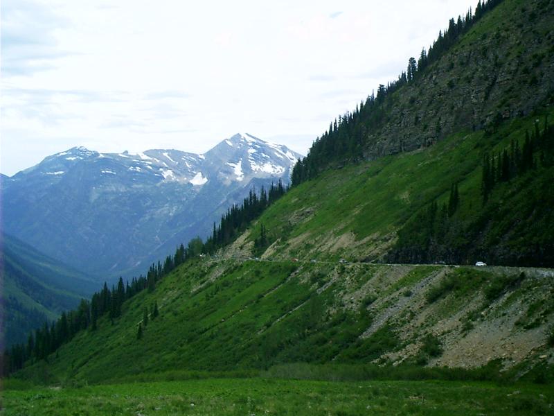
Upper St Mary Lake, Glacier ParkDon't miss riding GttSR; just be aware that it is heavily traveled. Vehicles wider or longer than 8x21 ft are prohibited. Drivers must be cognizant of overhead clearance of tall vehicles. There are time-of-day regulations about which lanes may be used by bicycles. Consider taking a bus tour.If you drive, go early. That way you will be able to find parking spots on the more popular turnouts. Be alert to other traffic of the four-wheel and the two-wheel kind. Also, watch for hikers of the two-foot and the four-hooved kind, crossing where sightlines are shortest. |
The Park CafeFrom an anonymous discussion-group posting:
US 89
St Mary, MT
406-732-4482
 |
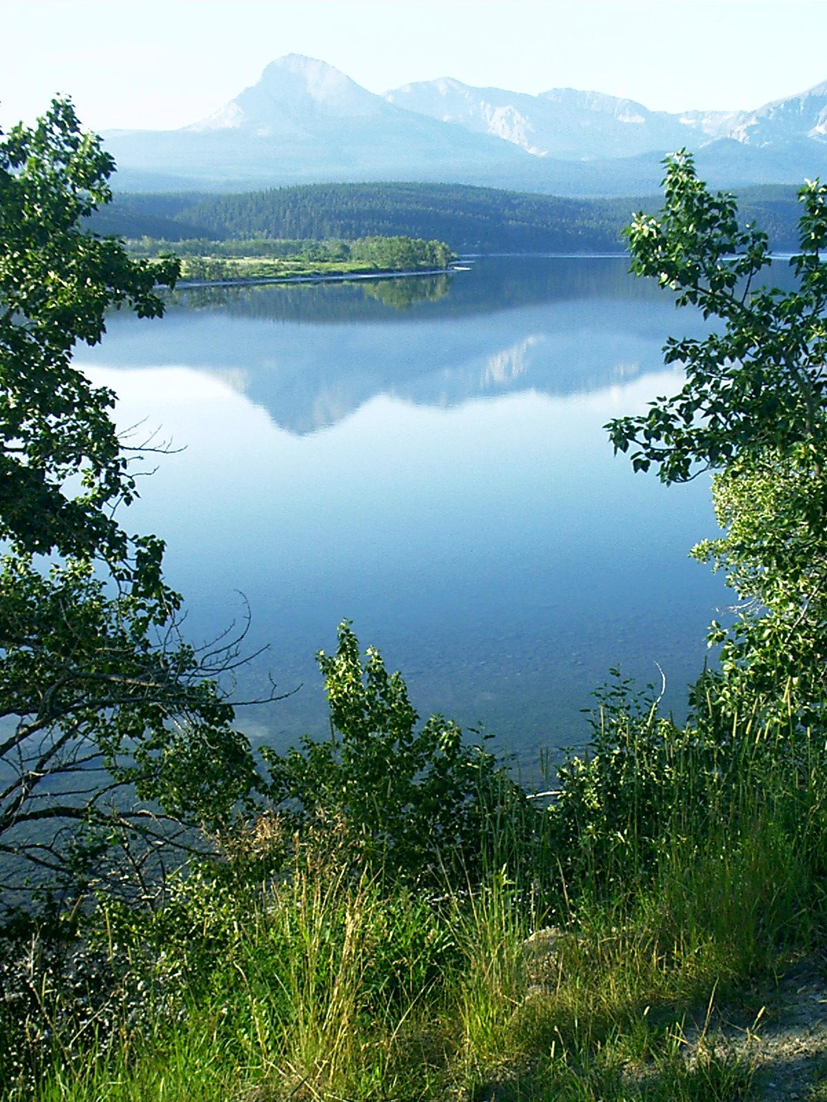
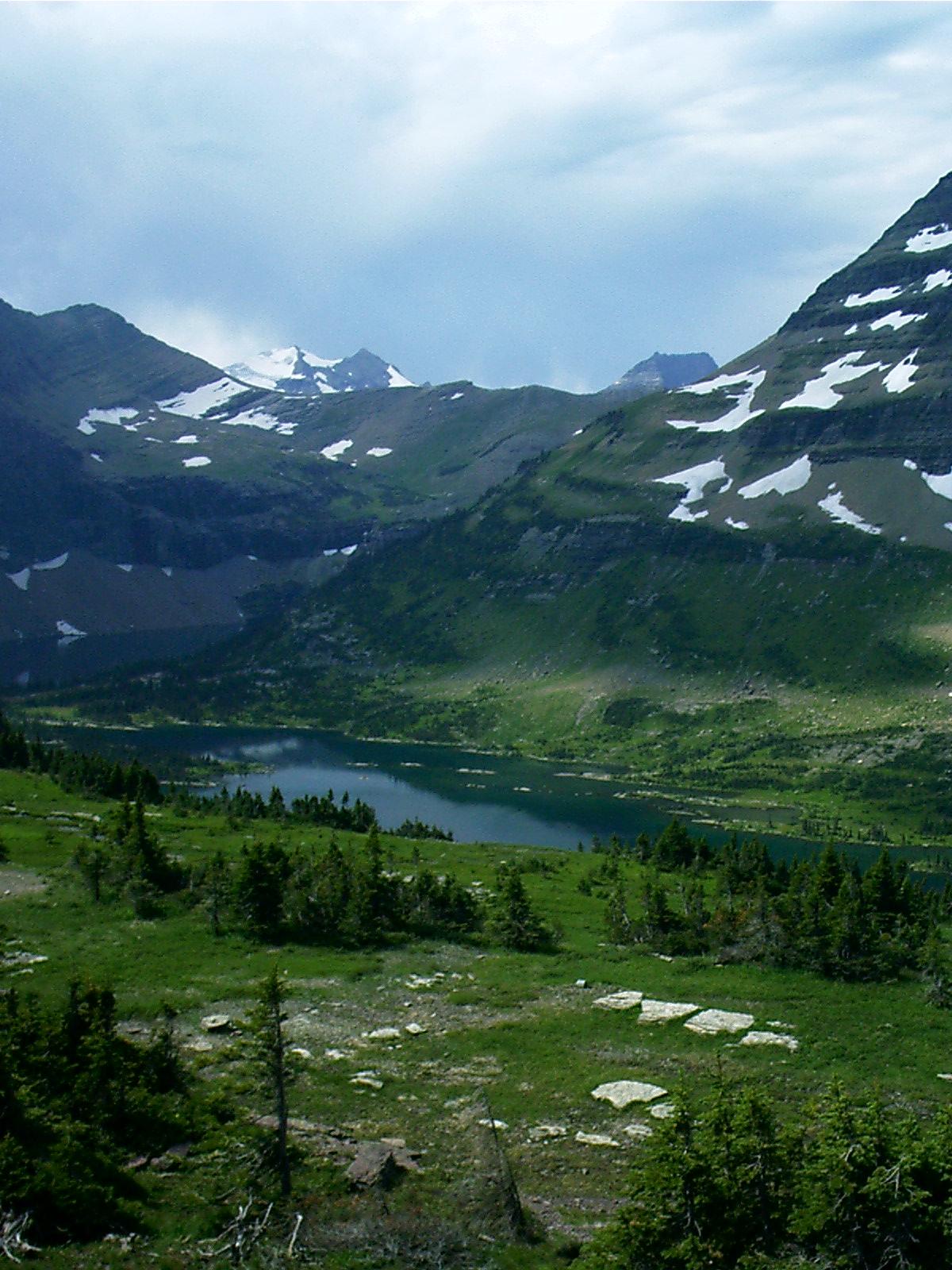
Triple Divide Peak, Glacier ParkSt Mary Lake in the foreground is in the watershed of the Saskatchewan River. Rain falling this side of Triple Divide Peak winds up in Hudson Bay. Triple Divide Peak is on the Continental Divide. Rain falling behind it to the left is captured by Cut Bank Creek and winds up in the Gulf of Mexico. Rain falling behind it to the right follows the Middle Fork of the Flathead River via Nyack Creek and winds up in the Pacific Ocean. |
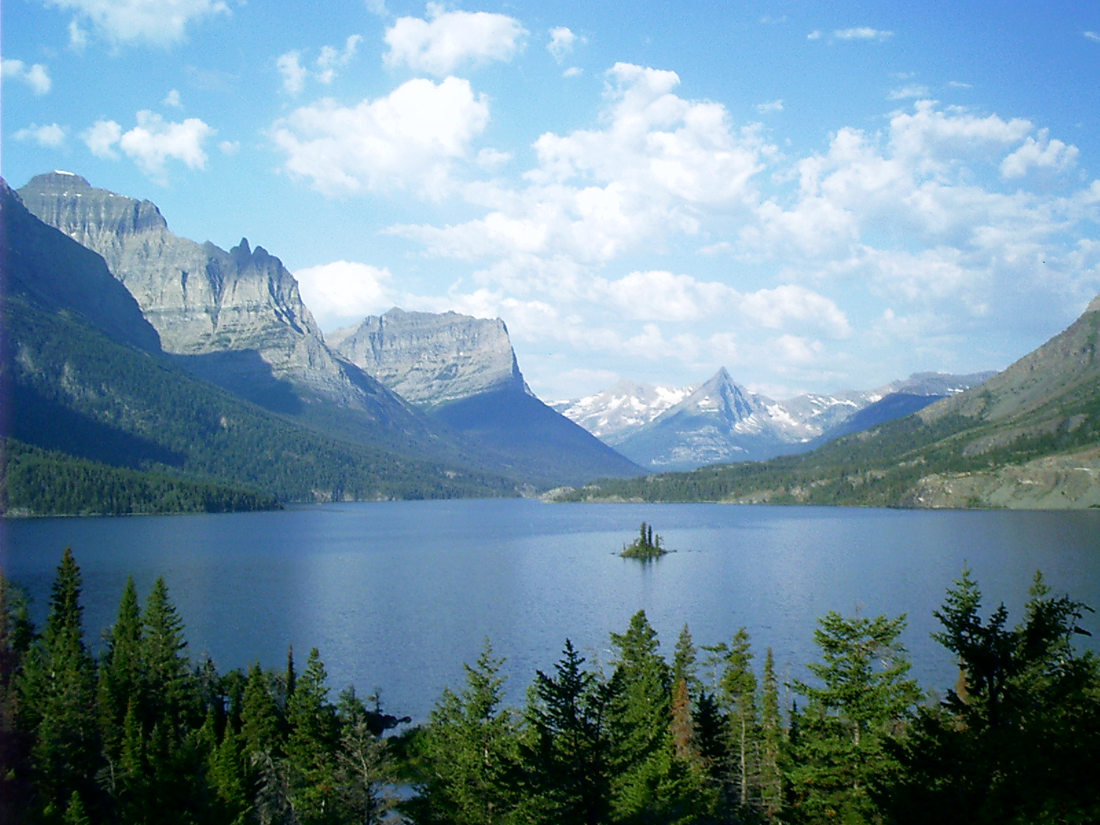 |
Wild Goose Island, Glacier ParkThis is the picture everyone takes. It's only a few steps from the turnout to the overlook. The legend is that a pair of geese occupied the island for a couple of years, but that was quite a while ago.Did I say everyone stops here? I meant everyone! This turnout is typically congested, but, if you take my advice and start early from the east side, you should be able to squeeze in. |
 |
Jackson Glacier, Glacier ParkThe sight of snowfields is commonplace, but this glimpse of Jackson Glacier is the only good view of a glacier that you can get from the road.The glaciers of Glacier National Park appear to be excellent barometers of climate change. For instance, there was a drastic rate of glacial retreat during the period from 1920-1940 when this region had above average summer temperatures and below average annual precipitation. From 1960-1979, several of the larger glaciers advanced very slightly during a period of greater precipitation and lower temperatures. Thus, long-term reductions in glacier size reflect long-term increases in average temperature and/or reductions in winter snow. [United States. Department of the Interior. Geological Survey. Northern Rocky Mountain Science Center. Abstract. "Glacier Monitoring in Glacier National Park." By Daniel Fagre and Carl Key. NRMSC Research N. vol. (25 Apr. 2003): 7 pars. Online. Internet. 27 Aug. 2004. Available http://www.nrmsc.usgs.gov/research/glaciers.htm.] |
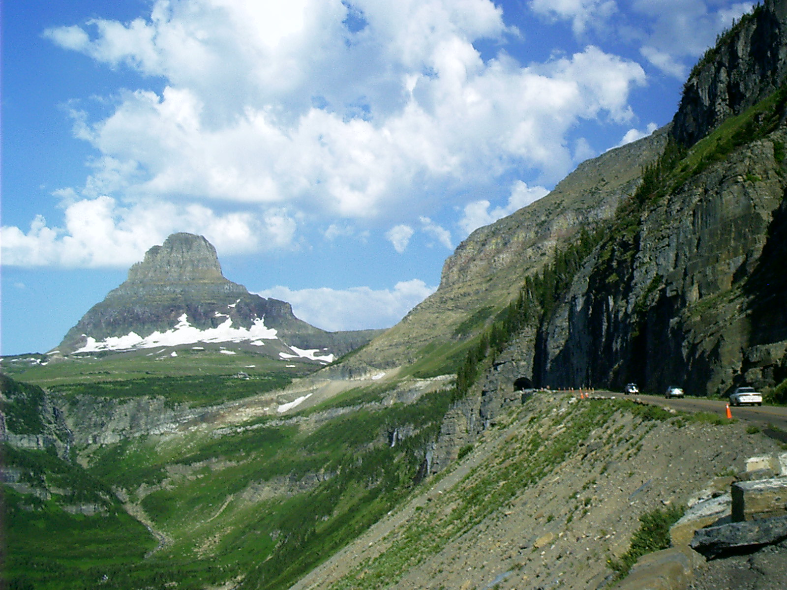  |
Tunnel, Sun Road, Glacier ParkThe Visitors' Center is "a monument to man in God's country," which sits on the saddle that is Logan Pass -- just to the left of center.Clements Mountain is an example of a glacial landform called a horn. I rode GttSR from St Mary to West Glacier. That way I was on the inside lane next to the north face of St Mary valley and along the Garden Wall west of Logan Pass. Opposing drivers from the flatlands were crowding and crossing the center line, trying to keep away from the low rock parapets separating them from the nothingness on their right hand. I reached the Logan Pass parking lot about 09:00 am. It was not full. There were a number of motorcycles in the lot, occupying special bike corrals, which are provided at both ends of every row of diagonally parked cars. I shinnied up the boardwalk to Hidden Lake overlook. They say this is a 1-1/2 mile trek, but they don't tell you how far up that is. As time wore on, the pedestrians passing me became numerous. By the time I returned to the parking lot about noon, the scene there was ugly. All the tourists that the lot could hold had joined a traffic melee, circling in their SUVs and slamming them into any conceivable space. From time to time there are proposals made to widen GttSR to three or four lanes. One supposes the intended result to be like I 70 through Glenwood Canyon, CO. These suggestions are taken no more seriously than those to initiate food service on Logan Pass where water must be hauled in and waste trucked out. |
 |
Garden Wall, Glacier ParkThe Garden Wall is an arete formed when two separate glaciers work on opposite sides of a divide. |
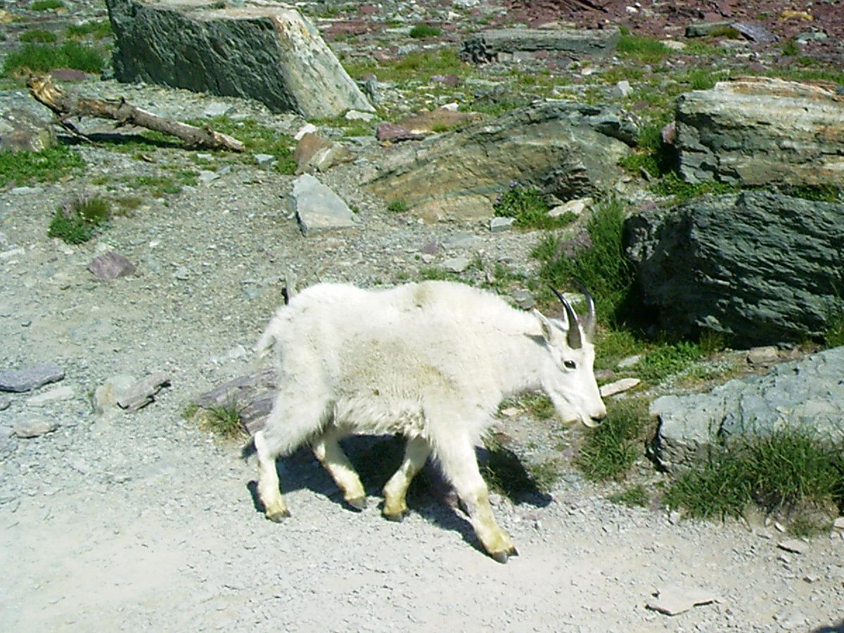 |
Mountain Goat, Logan Pass, Glacier ParkBesides avoiding the crowds along the boardwalk, another advantage to an early start is seeing wildlife, which regularly retires in midafternoon. This goat leaves the hubbub to take a siesta.Tourists are strongly cautioned not to approach wildlife and, when possible, are restrained from doing it by the Park Service. Wildlife relies on this and presents a fearless aspect. |
 |
Mountain Goat, Logan Pass, Glacier ParkTaking pictures is a good time. It makes your eyes active and your mind alert. You feel grateful when opportunity and ambition coincide. My advice, for what it's worth, is:
|
 |
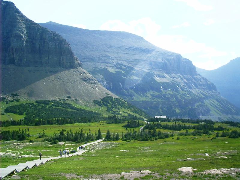
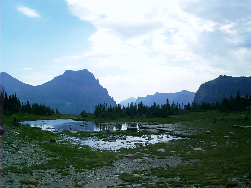
Hidden Lake, Glacier ParkEventually, one reaches the Hidden Lake overlook. |
 |
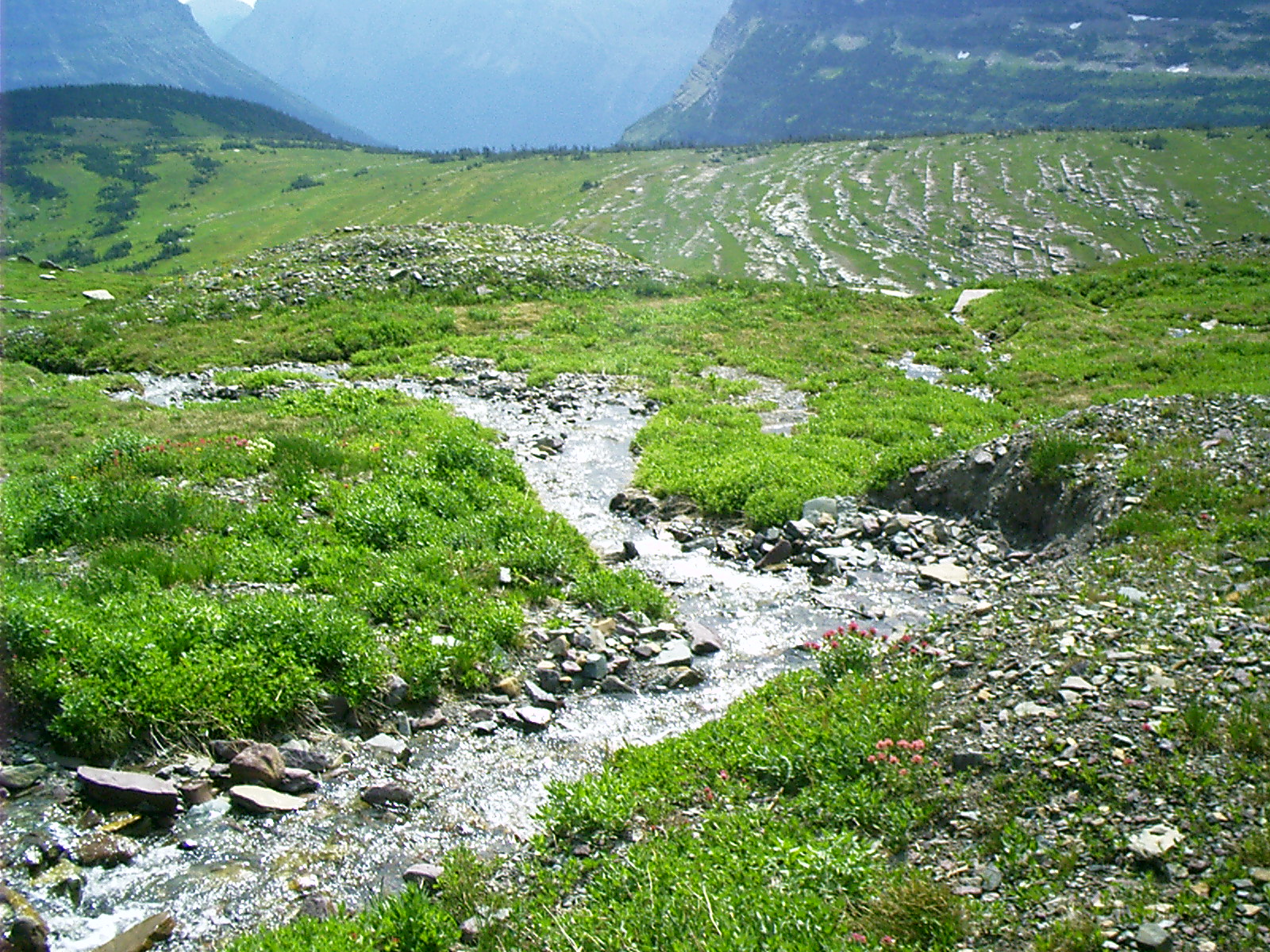
Near Logan Pass, Glacier ParkThe trail to Hidden Lake crosses the Continental Divide. This is about as far from drainage as land can get. |
 |
Glacial Striations, Logan Pass, Glacier ParkThe contours of the rock layers at the upper right are grooved straight across by abrasive stone carried in the glacier that leveled this meadow. The grooves are aligned in the direction of flow. "Did you see a glacier run through here just now?" "Yep, it went thataway." |
 |
Krummholz, Logan Pass, Glacier ParkThese trees are growing at their altitude limit. Environmental stress impacts their shape. |
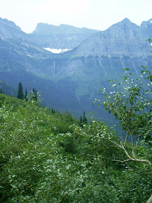 |
Bird Woman Falls, Glacier ParkDescending GttSR from Logan Pass toward West Glacier, one finds the scenery no less impressive than that east of the Continental Divide.Glaciers carve U-shaped valleys. When they retreat, they often leave hanging valleys, which end in midair. |
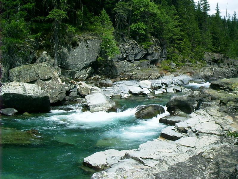 |
McDonald Creek, Glacier ParkThere is a large turnout near a newly erected complex of stairs and platforms, which facilitates sightseeing concomitant with the unloading and reloading of buses. |
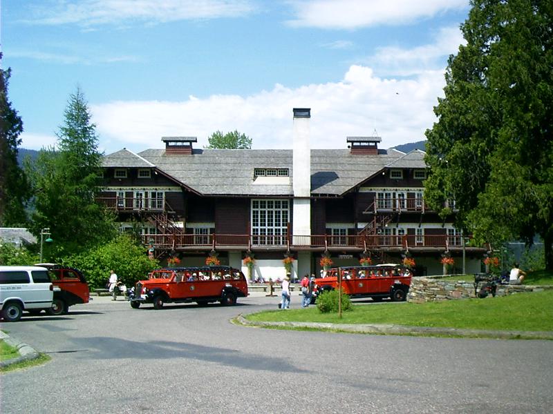 |
Lake McDonald Lodge, Glacier ParkBuilt in 1913 by John Lewis, Lake McDonald Lodge was known as the Lewis Glacier Hotel until 1957 even though the Glacier Park Hotel Company, a division of the Great Northern Railway, had acquired the concession in 1930.This building predates roads in the area. Patrons arrived by boat. Thus, it faces the lake. This, the landward side, is the rear of the structure. |
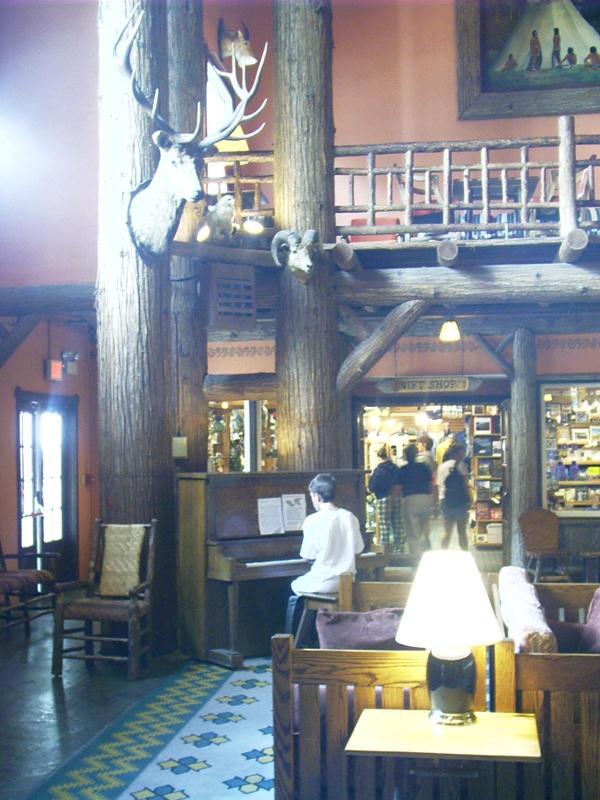 |
Atrium, Lake McDonald Lodge, Glacier ParkMr. Lewis' collection of hunting trophies is still displayed in the lobby. |
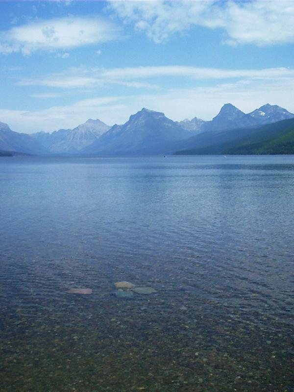 |
Lake McDonald, Glacier ParkI reached Apgar at the lower end of the lake about 03:00 pm. This is the western terminus of GttSR. |
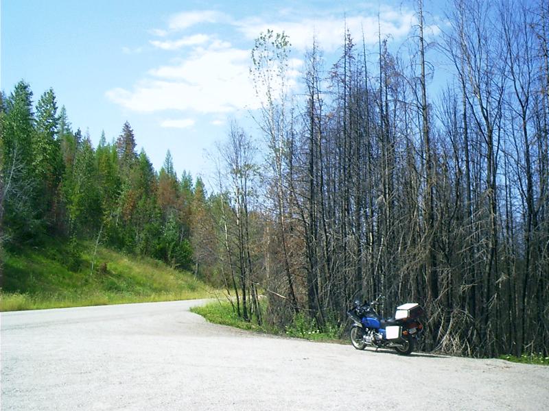 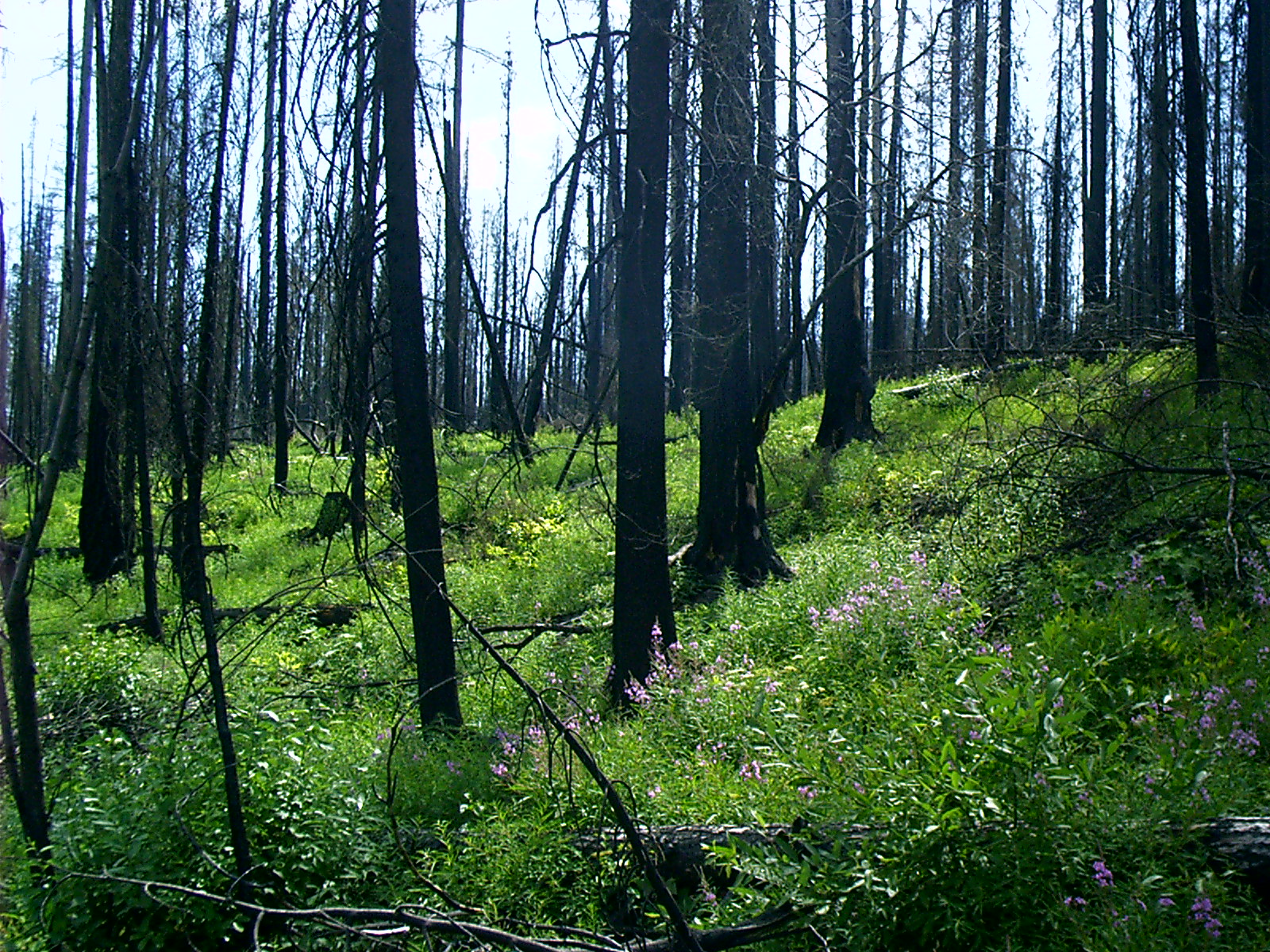 |
Fire Kill, Glacier ParkAbout a year ago in 2003, wildfire swept around the north side of Lake McDonald. As is usual with wildfire, it burned erratically. In this place, the road served as a firebreak.The flora and fauna of the Rockies are fire adapted and regenerate quickly after wildfire burns. Fireweed seeds are omnipresent and germinate where the soil is disturbed. Thus, fireweed is one of the first species to take advantage from fire's passing by. |