Chapin Mine Pump, Iron Mountain, MI
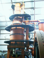 |
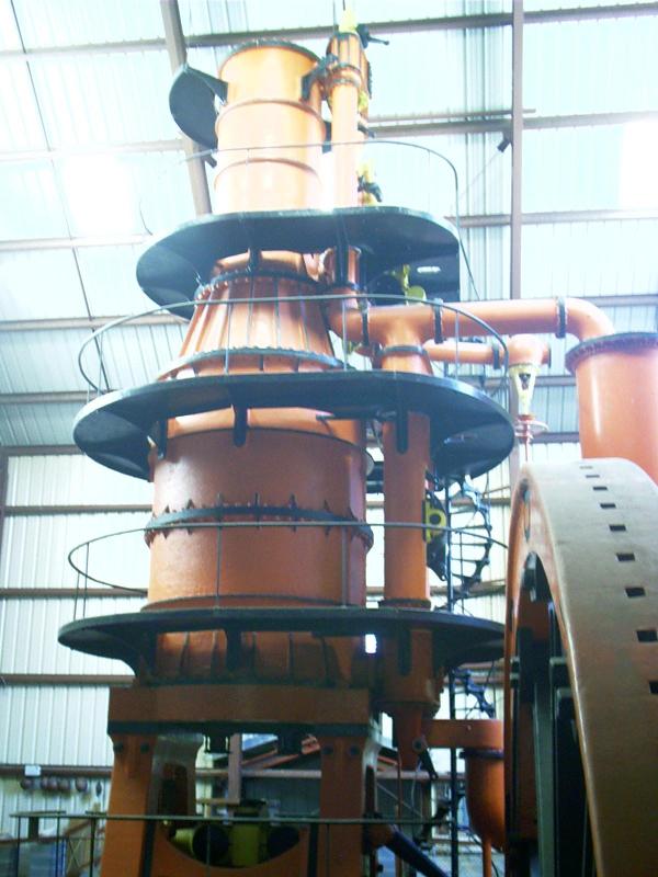
Cornish Pumping Engine
The Cornish
Pumping Engine is located at a closed mine head in Iron
Mountain, MI. Though made in the United States, it was patterned
after pumps used to dewater tin mines in Cornwall, England. An
exhibit hall was built around the engine in 1982.
Iron Mining Museum
300 Kent St
Iron Mountain, MI 49801
906-774-1086
800-236-2447
|
The ore body of the Chapin Mine at Iron Mountain in the
Menominee Range was considered unminable until it was drained by
one of the largest pumping engines ever built. In 1880, miners sank
a shaft through 90 feet of quicksand under a cedar swamp by
freezing the soil. Mining continued at the D shaft for ten years,
using conventional pumps. Eventually, Edward P. Allis Company of
Milwaukee was contracted to build the gigantic pumping engine,
which is now designated a landmark. This engine began operating in
1893.
The Chapin Mine pumping engine is a steeple compound condensing
engine capable of lifting 200 tons of water a minute, equivalent to
four million gallons a day. [See a fact sheet
about
the engine from the Menominee Range Historical Foundation.]
The D shaft was pumped to a depth of 600 feet. Then the pumping
engine was moved to the Ludington Mine, which had been abandoned in
1891. The Chapin engine pumped to a depth 1,513 feet at the newly
designated C shaft.
["Chapin Mine Pump (1893)." The American Society of
Mechanical Engineers N. vol. (N. d.): 3 pars. Online. Internet.
20 Aug. 2004. Available http://www.asme.org/Communities/History/Landmarks/Chapin_Mine_Pump_1893.cfm.]
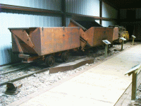 |
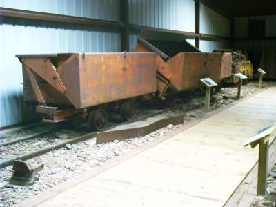
Mine Carts, Automatic Dump
The Cornish Pump Museum houses mining artifacts large and
small.
|
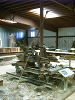 |
Mine Drill
|
 |
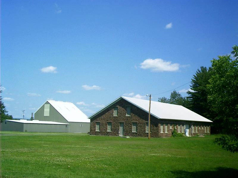
Infrastructure
This building was where miners changed into their work
clothes
before proceeding to the head frame to begin their work shift. The
new exhibit hall surrounding the pump engine is to the
left.
|
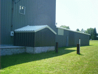 |
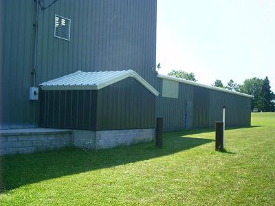
Site of the Head Frame
The small shed off the exhibit hall (left center) covers the
end of the walking beam that supported the pump rod, which
connected water cylinders on eight different levels deep in the
mine.
|
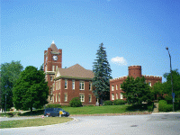 |
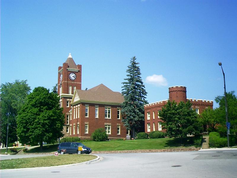
Dickinson County Courthouse (1896)
Iron Mountain, MI, is the county seat of Dickinson County in
the Upper Peninsula. |
The Upper Peninsula of Michigan is also known as "The
Upper Peninsula", "The U.P." (or "The UP"), and "Above the Bridge"
by Michiganders, and is sometimes called "Northern Michigan" by
non-Michiganders ("Northern Michigan" usually refers to the
northern half of the Lower Peninsula, to Lower Peninsula
residents).
The Upper Peninsula of Michigan is separated from the Lower
Peninsula of Michigan by the Mackinac Straits [pronounced
Mackinaw], five miles across at its narrowest, and is connected to
it only by the Mackinac Bridge. Until the bridge was completed [in
1957], travel between the two peninsulas was difficult and slow
(and sometimes even impossible during winter months). Car ferries
ran between the two peninsulas, and at the busiest times of year
the wait could stretch to hours. In winter travel was only possible
over the ice after complete and solid freeze-up of the
straits.
The residents of the Upper Peninsula are often called
"Yoopers", (from "U.P.ers"), and many consider themselves Yoopers
before they consider themselves Michiganders. (People living in the
Lower Peninsula are commonly called "trolls" by Yoopers, as they
live "under the Mackinac Bridge.") This regionalism is not only a
result of the physical separation of the two peninsulas but also
the history of the area. The U.P. was not originally a part of
Michigan Territory; it was given to the 30-year-old Michigan
Territory in 1835 only a few years prior to statehood, as a
settlement to end the Toledo War being fought between Michigan and
Ohio over the city of Toledo. Before this, it had been part of
Wisconsin Territory. Ohio got the city of Toledo and was considered
the winner. So, not only did the Lower Peninsula of Michigan exist
for 30 years without the Upper Peninsula, but the entire Upper
Peninsula was considered less valuable than the city of Toledo.
Today, many residents of the western half of the Upper Peninsula
still associate themselves with Wisconsin, possibly because the
urban areas, shopping malls and Universities in Wisconsin are a
much shorter drive than those in the Lower half of the State. (It
is perhaps due to this association with Wisconsin that there are
many fans of the Green Bay Packers in the Upper
Peninsula.)
["Upper Peninsula of Michigan." Wikipedia N. vol. (21
July 2004): 10 pars. Online. Internet. 20 Aug. 2004. Available
http://en.wikipedia.org/wiki/Upper_Peninsula_of_Michigan.]
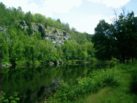 |
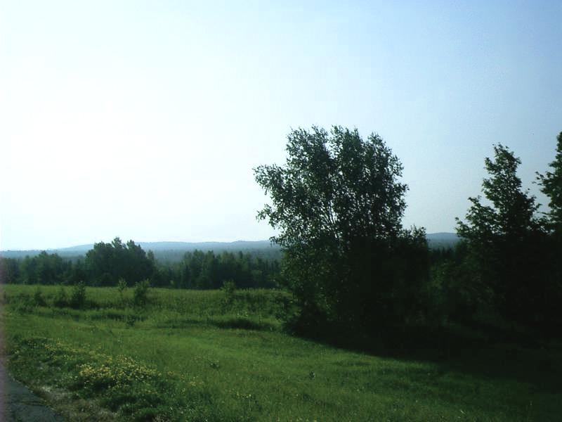
Menominee River at Niagara, WI
Menominee is Algonquin for "wild-rice people." The Menominee
River forms part of the state boundary between upper Michigan and
Wisconsin. It gives its name to the iron range where Iron Mountain,
MI, is located and to the city and county in the Upper Peninsula.
The river is not anywhere near and ought not to be confused with
the Menominee Indian Reservation on the Wolf River in Menominee
County, WI, the city of Menomonee Falls on the Menomonee River in
Waukesha County, WI, or the city of Menomonie on Lake Menomin on
the Red Cedar River in Dunn County, WI.
|
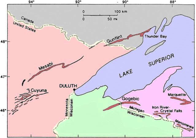
- The term "iron-formation" is perhaps the most enigmatic and
controversial term ever concocted for a rock type. Iron formations
were deposited in many parts of the world during the Early
Proterozoic (Precambrian) in formations that are 500 to 2,000 feet
or more thick and that extend for hundreds of miles. Therefore,
thousands of cubic miles of iron-rich sediments were deposited in a
number of basins. After the Early Proterozoic (about two BILLION
years ago) deposition of iron-formation ceased, and this
distinctive rock type is essentially absent from younger geological
sequences.
Thus, we are left to puzzle over where the vast quantities of iron
came from during the Early Proterozoic, and why iron is not found
in younger rocks. This all suggests that a major change in the
chemistry of the surface environment of the earth must have
occurred around two billion years ago to prevent iron-formation
deposition in younger rocks. Most geologists now believe that the
major change was the development of an oxygen-bearing
atmosphere on earth. Iron is relatively soluble in an
oxygen-deficient environment (like that of the earliest
Precambrian) and therefore would be present in large amounts in
ocean waters. In oxygen-rich environments, like the present
atmosphere, iron is incredibly insoluble and therefore is not
present in quantity in ocean waters.
- Iron-formations have played an important part in the
settlement and economic development of the Lake Superior region,
for these rocks are the source and host for a vast majority of the
iron ore produced in North America. The map below shows that iron
formations are commonplace throughout the Lake Superior region. The
largest of these is the Mesabi Range in Minnesota.
- Throughout the Lake Superior region the mining of natural
ores has been phased out in favor of mining and mechanical
concentration of taconite. Taconite is iron-formation that has not
been oxidized and enriched by natural processes. Two factors have
contributed to the demise of the mining of natural ores: (1)
natural ore bodies have been largely mined out, and (2) blast
furnaces are more efficient when using processed, rather than raw,
ores. The tremendous consumption of iron ore during World War II,
when the Lake Superior region was the major producer of iron ore
for the Allied forces, was the zenith of production of natural
ores. A rapid decline in the mining of natural ores was accompanied
by major technological advances that led to the development of the
taconite industry. By 1950 the industry knew how to concentrate the
low-grade taconite ore into higher-grade forms, but not how to
pelletize it. When the Korean War broke out in 1950, fears of
domestic resource exhaustion were rekindled. Under the Defense
Production Act of 1950, Congress quickly enacted loan guarantees,
rapid tax write-offs and other tax policies that helped specific
industries. This act was designed to "encourage the exploration,
development and mining of critical and strategic minerals and
metals." It worked. Thus, the biggest problem the iron ore industry
faces today is that attempts to produce more iron are working too
well. Today we are far closer to a glut than a scarcity.
Technology's solution of pelletizing low-grade taconite is the most
intriguing. It produced results that few had expected--results that
scientists have called counter-intuitive. It made low-grade ore
better than the high-grade ore once used. And it did so in a way
that saved energy and labor.
- All of the Marquette Range ore currently mined is excavated
from open pits using diesel-powered off-road trucks loaded by
electric and diesel-powered shovels. The ore, which in the ground
consists of 25 to 45 % iron by weight, is pelletized at processing
plants adjacent to each mine. First ground to a fine powder, the
ore is next concentrated using magnetic separation and flotation to
60 to 65 % iron, then rolled into 3/8" diameter pellets that are
purplish-gray when they emerge, steaming, from the plants. The rust
color of pellets that have lain exposed to the weather is entirely
natural, as the iron in the pellets is chemically combined with
oxygen to form iron oxide, more commonly known as rust. Small
amounts of silica, alumina, manganese, limestone and bentonite make
up the rest of the pellet. Bentonite (an extremely sticky clay) is
added at the rate of 16 lbs per ton as a binder. Limestone, which
serves as a flux in the steel-making process, is added to the
pellets at the processing plants to simplify blending at the steel
mills. The limestone comes in on inbound ore boats to both
Marquette and Escanaba. At Marquette, it is offloaded at the Upper
Peninsula Power Plant adjacent to the LS&I ore dock and hauled
by truck to the Empire and Tilden Mines. The Chicago &
Northwestern Railroad hauls the limestone unloaded at Escanaba to
the Empire Mine in ore cars.
- All of the underground mines that for over a century were
the backbone of Marquette Range production have long since closed,
and it is highly unlikely that they will ever reopen.
[Schaetzl, Randall J. "Geography of Michigan and the Great
Lakes Region: Iron Mining: Where and Why?" Michigan State
University N. vol. (21 Mar. 2001): 4 pp. Online. Internet. 20
Aug. 2004. Available http://www.geo.msu.edu/geo333/iron.html.]
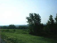 |
Gogebic Iron Range
Gogebic is pronounced Go-GIB-ik with two hard G's. Text of
Roadside Marker: The Gogebic Iron Range, which
may be
seen to the south of here extends for 80 miles from Lake Namekagon,
Wisconsin, to Lake Gogebic (Chippewa for "place of diving") in
Michigan. Prior to the discovery of iron ore, the area was
relatively uninhabited as the land was ill-suited to agriculture.
Nathaniel D. Moore uncovered ore deposits in the Penokee gap near
Bessemer in 1872, but it was not until 1884 that the first mine
shipment was made. The news spread rapidly, attracting speculators,
investors and settlers. By 1886 there were 54 mines on the range,
and the area was boomed as having "inexhaustible deposits of
uniformly high-grade Bessemer ores." For a brief period stocks rose
1200 percent. The crash in 1887 ended the extravagant
prosperity. |
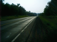 |
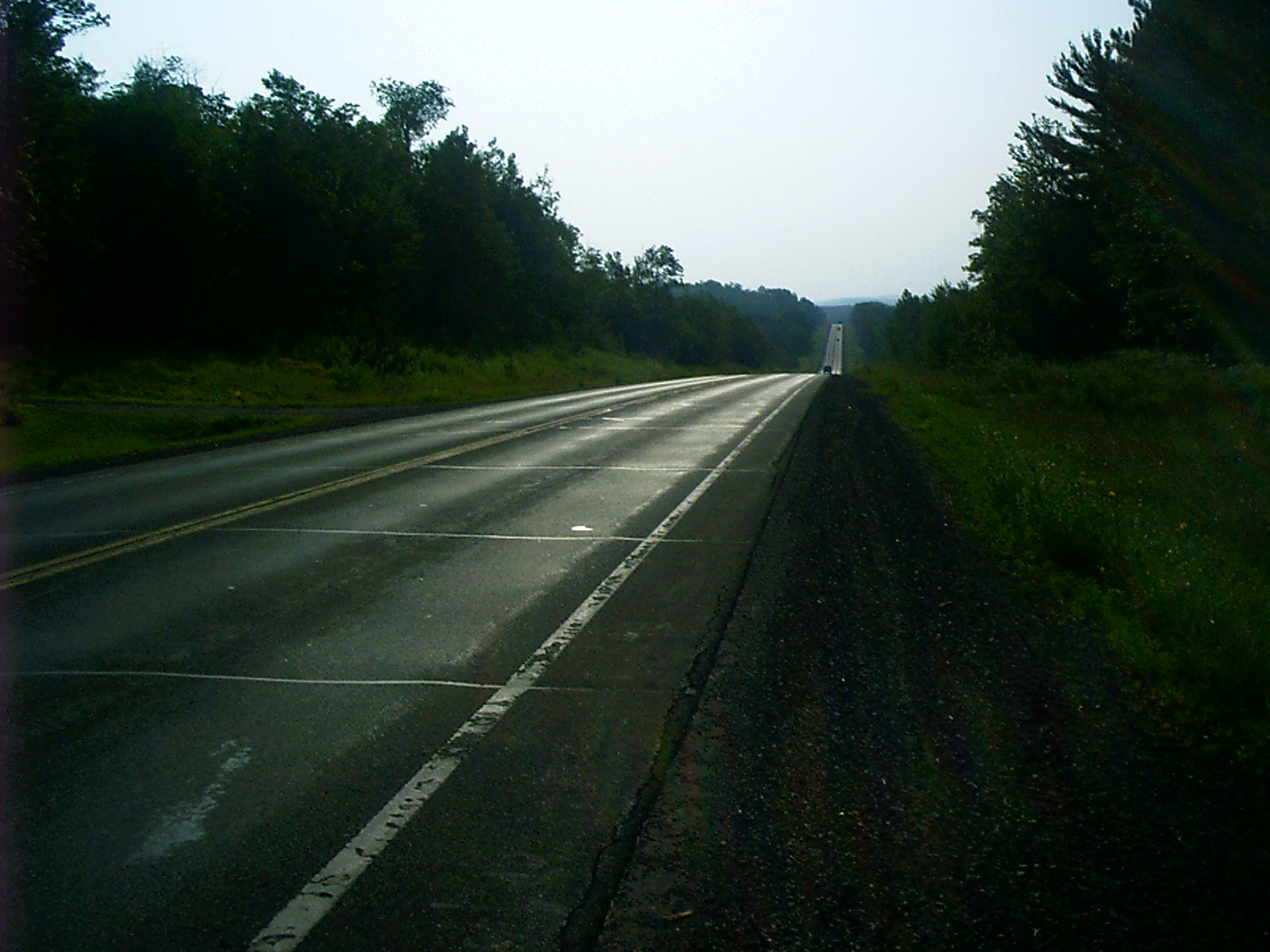
US 2, The Hi-Line, in Wisconsin
US 2 runs from Everett, WA, to St Ignace, MI, and from Rouses
Point, NY, to Houlton, ME. Canada has no single-numbered connecting
highway from Sault Ste Marie through Ottawa, ON, and Montreal, QC.
On my motorcycle trip, I picked up the Hi-Line in Iron Mountain,
MI, and traveled all the way west through Duluth, MN, to Browning,
MT. Through the iron ranges, it threads its way -- over the
Canadian Shield, through Indian reservations. On the margins of the
Missouri and the Milk it goes -- past the Sweet Grass Hills, the
surplus of creation, to ascend the Rockies through Marias
Pass. |
Rhode, Chuck.
"Chapin Mine Pump, Iron Mountain, MI."
The Hi-Line and the Yellowstone Trail: To Glacier Park and Back Again.
1 Sept. 2004.
Lacus Veris.
8 Jun. 2026
<http://lacusveris.com/The Hi-Line and the Yellowstone Trail/The Northwoods/Chapin Mine Pump.shtml>.
Last modified 3 Nov. 2025.
Served 21584 times between 16 May. 2010 and 9 Jun. 2026.
Contact mailto:CRhode@LacusVeris.com?subject=LacusVeris.