|
|
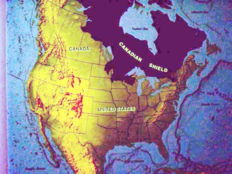
This exhibit at the Northern
Great Lakes Interpretive Center shows the extent of the Canadian
Shield, an area underlain by impermeable bedrock covered by poorly
drained, acidic soils of low fertility. Below the Arctic, the
Shield is mainly forested and is thinly populated. Because of not
only flat and boggy but also uneven and boggy terrain, road
building through the area is particularly difficult. US 2 traverses
the Canadian Shield in the Upper Peninsula of Michigan and in
northern Wisconsin and Minnesota. |
The Canadian Shield is a large geographic area in eastern and central Canada, composed of bare rock dating to the Precambrian era (between 4.5 billion and 540 million years ago). It is also called the Precambrian Shield, or Laurentian Shield, or Laurentian Plateau.
The shield is approximately U-shaped, with the points in the arctic. It covers much of Greenland; Labrador; all of Quebec north of the St. Lawrence River; much of Ontario outside the southern peninsula between the Great Lakes; upstate New York; parts of Michigan, Wisconsin, and Minnesota; the central portion of Manitoba away from Hudson's Bay and the Great Plains; northern Saskatchewan; a small portion of north-eastern Alberta; and the mainland northern Canadian territories to the east of a line extended north from the Saskatchewan/Alberta border (Northwest Territories and Nunavut). In total it covers approximately eight million square kilometers.
Such a large area of exposed, old rock requires some explanation. The current layout of the Shield is one of very thin soil lying on top of the bedrock, with many bare outcrops. This arrangement was caused by glaciation during the last Ice Age, which covered the shield and scraped the rock clean in doing so. The multitude of rivers and lakes in the entire region is caused by the watersheds of the area being so young and in a state of sorting themselves out. The shield was originally an area of very large mountains and much volcanic activity, but over the millennia the area was eroded to its current much flatter appearance.
Mountains have deep roots and float on the denser mantle much like an iceberg at sea. As mountains erode, their roots rise and are eroded in turn. The rocks that now form the surface of the shield were once far below the earth's surface. The high pressures and temperatures at those depths provided ideal conditions for mineralization.
The shield is one of the world's richest areas in terms of mineral ores. It is filled with substantial deposits of nickel, gold, silver, and copper. Throughout the north of Canada there are many mining towns extracting these minerals. The largest, and best known, is Sudbury, Ontario. Sudbury is an exception to the normal process of forming minerals in the shield since the Sudbury Basin is believed to be an ancient meteorite impact crater.
The shield, particularly the portion in the Northwest Territories, has recently been the site of several major diamond discoveries. The kimberlite pipes in which the diamonds are found are of relatively recent origin, and one theory of their origin suggests that the shield was at some time in the past above a hot spot in Earth's mantle (much like the one that formed Hawaii, but under land rather than ocean). The spot lifted the surrounding landscape as continental drift moved over it, forming the pipes in various locations. The line of [underwater] subsurface mountains that runs from the eastern seaboard of the United States nearly to Europe before culminating in the Challenger Seamount would, if run backwards in time, follow a path that matches what is suggested.
The shield is also covered by vast boreal forests that
support an important logging industry.
["Canadian Shield." Wikipedia N. vol. (23 July 2004):
7 pars. Online. Internet. 22 Aug. 2004. Available http://en.wikipedia.org/wiki/Canadian_Shield.]
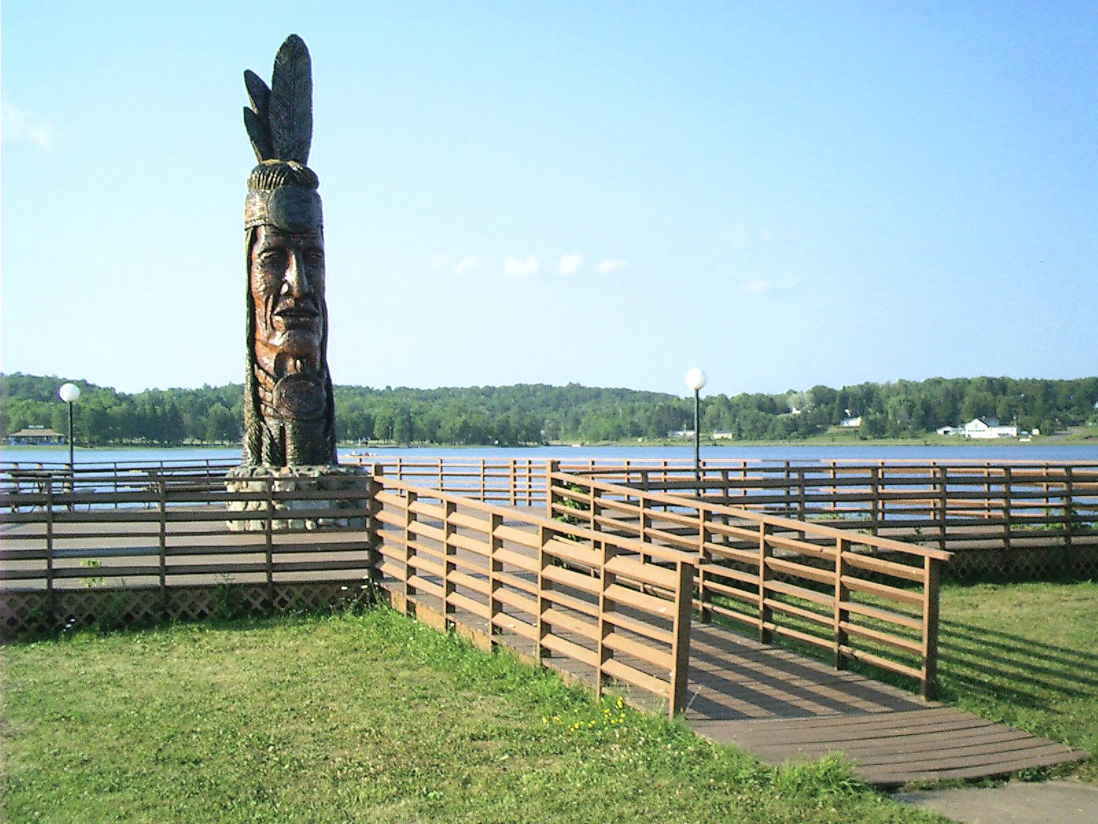 |
Nee-Gaw-Nee-Gaw-Bow (Leading Man)
The statue on the south shore of Sunday Lake at Wakefield,
MI,
was carved out of a pine stump from the Ottawa National Forest by
Hungarian sculptor and writer Peter
"Wolf" Toth in 1988 to honor the Chippewa Indians. It is one in
a series of five dozen scattered throughout North America called
"The Trail of Whispering Giants." |
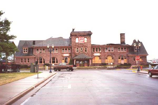 |
Soo Line Station, Ashland, WI (before)
This classic brownstone depot housing food services and
offices
burned on 1 APR 2000. |
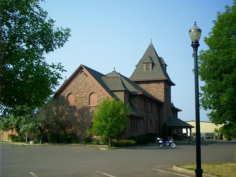 |
Soo Line Station, Ashland, WI (after)
The building's exterior has been reconstructed, but it still
stands unoccupied. |
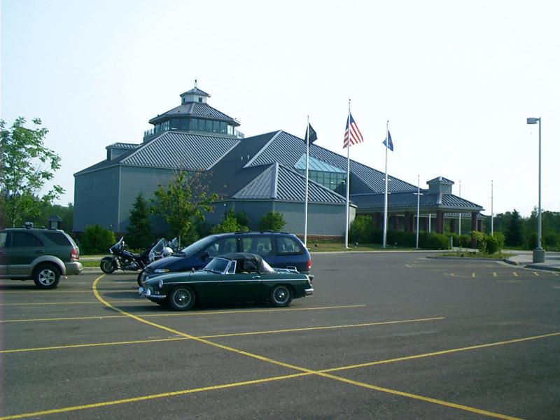 |
Northern Great Lakes Interpretive Center, Ashland, WIThe Northern Great Lakes Regional Visitor Center is located 2 miles west of Ashland, Wisconsin on U.S. Highway 2. It features an observation tower, 100 seat theater, visitor information/trip planning area, interpretive exhibits, historical archives/research area, classroom/meeting rooms, outdoor amphitheater, interpretive trails and gift store. The five story observation tower overlooks Lake Superior and the Ashland skyline.The Center presents an overview of the historical interaction of human cultures and the land and natural resources of this region from the Ice Age to the Present. Our region includes the northern thirds of Wisconsin, Minnesota and Upper Peninsula of Michigan. It touches the shores of two Great Lakes, Michigan and Superior, and has a larger concentration of public lands than any other region east of the Mississippi. It is unified by a shared geology, ecology, history and a common heritage. |
Great American Bar & GrillIt had become rather late by the time I finished playing on the Internet; nevertheless, I ventured back out onto the Canadian Shield. The land became level, dark, and featureless. I despaired of finding a campsite and took a room at:
Miller Hill Mall
Duluth, MN
218-740-1600
Stardust MotelLo and behold, wireless worked there, too. The sun was well up before I packed my toys and headed down the road. The land was level, marshy, and featureless.
112 W Highway 2
PO Box 282
Floodwood, MN 55736
218-476-2340
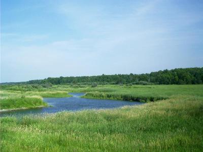 |
Mississippi River near Ball Club, MN... you have to believe this creek is of larger significance than the wide Missouri and rightfully lends its name instead to the mightiest watershed, which draws all streams toward the Gulf of Mexico from the continent's interior. |
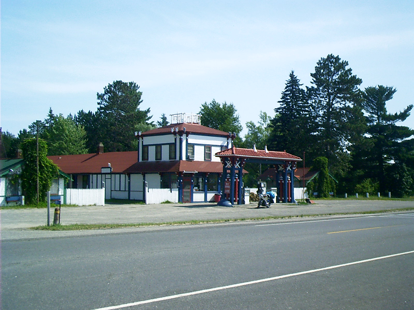 |
General Store, Bena, MNThis general store is the gateway to Lake Winnibigoshish and the resort community of Bena, MN. I regret the bogus attribution to architect Frank Lloyd Wright that appeared here until April 2012, which laughably arose from my (and others') confusing it with the R.W. Lindholm Service Station in Cloquet, MN. |
 |
Paul Bunyan and Babe, Bemidji, MNErected in 1937, these statues commemorate the birthplace of the giant lumberjack and his big blue ox, but this is a bogus memorial. Everyone knows Bunyan was born in Presque Isle, ME, and walked from camp to camp through the Dakotas all the way to Walla Walla, WA, following the timber harvest. Today, he commutes (by motorcycle) between offices in Seattle, WA, and Anchorage, AK. |
Cabela's ShowroomIt's a great place to stretch your legs and indulge your inner hunter/gatherer.
210 DeMers Ave NW
East Grand Forks, MN 56721
218-773-0282
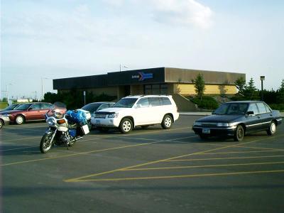 |
Amtrak Station, Grand Forks, NDWhy include a picture of this perfunctorially functional modern depot? After all, how can it compare with the architectural monuments put up by the railroads in the past century? Well, using any depot at all is better than stopping and putting a step down at a grade crossing, which is what the railroad used to do in several regions and still does in a few, but my reason is this: To the west, US 2 adjoins the mainline of the Great Northern Railway -- now the route of Amtrak's Empire Builder passenger service, and this is where they come together. Anyway, I thought terrorists might be interested. |
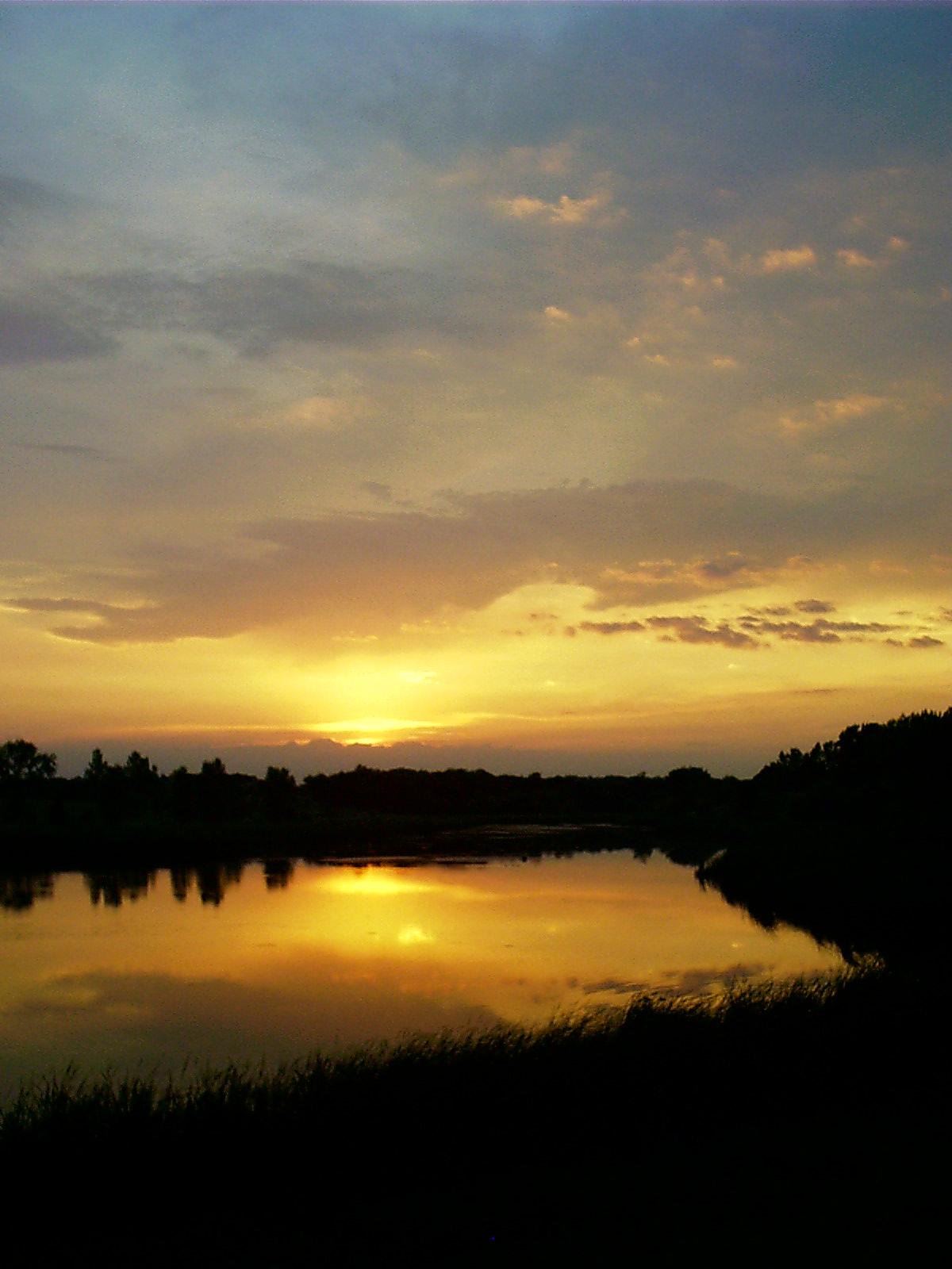 |
Turtle River State Park, Arvilla, NDRed sky at night; campers take
fright.
... so it was late in the day when I dropped off the edge of the Canadian Shield into the park near Arvilla, ND. Turtle River State ParkI was running on reserve and inquired seriously of the host and hostess as to sources of fuel. They told me there weren't any services nearby but in Larimore, ND, seven miles away, so, after putting up my tent, I poured my spare bottle into the tank and rode to supper. I snapped this picture on my way. 4-1/4 gal of gasoline filled the tank and also the spare. At the Red Dog Saloon, I consumed a pizza. It was truly dark when I returned to camp. Just after midnight or slightly before, the clouds you see on the horizon blew through, bringing with them gusty winds, a little rain, and an unbelievable electric display. I considered fleeing to the nearest building but decided I ought to stay on my back, lying low until the storm was over. |